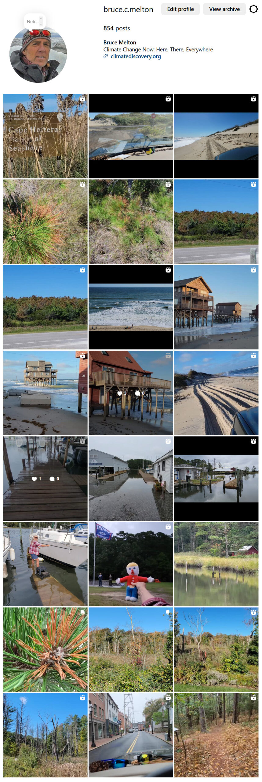
Climate Change Across America Filming Report, September/October 2024: East Coast and New England – A Summary
Bruce Melton
This season we witnessed 13,000 miles of climate change across the Eastern US from Texas to New England and down to the Outer Banks. We look mostly at natural systems degradation from warming effects, where this degradation grows more and more extreme even if we stop all warming this instant. This is because once degradation begins, it is then foregone that the system will collapse so that new species and mechanisms tolerant of the warmer conditions can evolve a new system. The degradation of our Earth systems is already creating feedback emissions and unless we cool or restore our currently warmed climate back to within the natural variation of our old climate at less than 1 degree C warming above normal, collapse feedback emissions will dwarf humankind’s.
These systems collapses: tropical, temperate and boreal forests; polar ice, ice sheets and permafrost; coastal impacts from sea level rise, other ocean processes, soils processes, and others, faltering of the Atlantic meridional overturning circulation (AMOS of which the Gulf Stream is a part); These systems collapses complete, like any collapse, unless the thing that caused it to begin is removed, or the boundary conditions of the systems’ evolution is restored. This Earth systems science, or the science behind climate tipping, is the basis for Sierra Club’s new policy on climate restoration (2020), where we cool from today, not allow additional warming to 1.5 degrees C above normal as our common global climate policy states. Sierra Club was the first organization of its kind anywhere on Earth to support a climate restoration policy.
This filming trip included 22 states in 23 days and 6,500 miles where we were immersed in the observation and interpretation of climate change effects. We made it all the way to the Adirondacks in Upstate New York, the Green and White Mountains of Vermont and New Hampshire, Acadia National Park in Maine, Cape Cod in Massachusetts, coastal areas in Connecticut and the Chesapeake Bay of Virginia, the Outer Banks of North Carolina and. The effects of climate change were literally all along our path, as usual, and they were very meaningful to life on this planet as we know it. Forest degradation is many times above normal in most places. In others it is not casually noticeable and then in others it is devastating. I am still entering logs and have made it to the King Tide erosion at Rodanthe, NC on the Outer Banks where a half dozen homes were lost to the sea this season. We also shot Asheville on the way back and a relief – almost all of the town above the floodway of the French Broad River is relatively unscathed with almost no tree loss or flooding. I am certain there is spotty sheet flow damage in the uplands of town, but there was almost no flood debris on the curb and we traversed downtown three times. The river is of course wiped nearly clean. East and north of Asheville, downed trees are substantial with stream erosion like nothing I have ever laid eyes on as a hydrologist. The flooding came from ten inches of rain the week before from a simple stalled cold front, then 20 inches with Hurricane Helene; in steep mountainous terrain. I saw images of the Blue Ridge Parkway last week with a near complete blowdown, and the news that some of the 200 miles of closure has reopened.
Everywhere we went: it’s drier, wetter, warmer, snow doesn’t accumulate, the warm season is longer; it was 88 north of Albany in the Adirondacks one day – the locals said that this kind of temperature is just not a thing this time of year. The locals have also noticed the increased forest mortality, so the public is becoming aware. A millennial-age employee of a marina on Lake Champlain said it no longer freezes completely and his grandfather, my age, once ran his cows across on the ice. Most agree that effects have become much more noticeable recently – many said in the last five years, like the gray-haired lifelong surfer at Cape Cod National Seashore’s Nauset Beach where Pleistocene dune erosion tops 25 feet and red pine scale kill is almost complete.
Image Description: King Tide Flooding on Chesapeake Bay. At a normal marina in our old climate, the highest high tide would be 12 to 18 inches below the deck of the pier but the King Tide has submerged this marina’s piers. King Tides are caused when both the moon and the sun combine to pull ocean water around the planet instead of just the moon like in normal tides. King’s happen twice a year in the spring and fall, with several “cycles” in each season with four to five very high tide days per cycle. Old marinas like this one have seen most of the 12 inches of sea level rise on the east coast in the last 30 years. Because of the extra corrosive activity from repeated submersion, the connectors on some of the piers in this marina have rusted away and the deck actually free-floats between the pilings, until one walks across it causing it to sink back to its original location atop the beams that connect pairs of pilings. See our Instagram feed for video logs of this marina and the rest of our Climate Change Across America filming trip.
Instagram Logs, 120 posts – https://www.instagram.com/bruce.c.melton/
Instagram Viewer for those without an Instagram account – https://www.picuki.com/profile/bruce.c.melton


